An early look at “Seeing Providence Chinatown”
I’d like to share an early iteration of an ongoing project, “Seeing Providence Chinatown: A virtual reconstruction of an erased neighborhood”
(in an effort to better compile my updates on this project, I’m reposting this from the Twitter thread here, originally share on Nov 14, 2021)

These are the only photographs remaining of the heart of Providence’s Chinatown, as collected by the PVD Chinatown project. They paint a very partial picture of what was once a vibrant cultural center and provider of services to the Chinese-American community of PVD.

However, many photographs exist of surrounding streets, from both just before & after Empire St was widened to destroy the neighborhood. Below, the rough envelope of the Chinatown Societies as they would have appeared a few years later on the newly widened Empire St, c1910

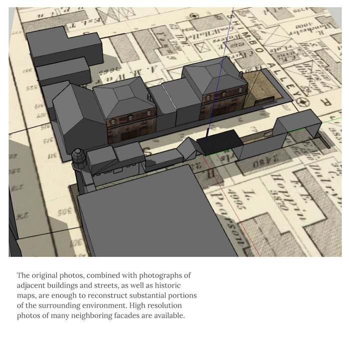
The original photos, combined with photographs of adjacent buildings and streets, as well as historic maps, are enough to reconstruct substantial portions of the surrounding environment. High resolution photos of many neighboring facades are available.

Working from the existing photos, it is also possible to estimate volumes, heights, & to make educated guesses at surface treatments in the neighborhood itself. Early attempts to model individual buildings resulted in enough detail to build a model, with relatively few gaps.

Further clues also help to orient the viewer in the existing photos, & provide a context for the fleeting glimpse we have of this neighborhood. To the right, a full view of the Central Baptist Church mentioned in the caption. Other buildings can be added in the same way.

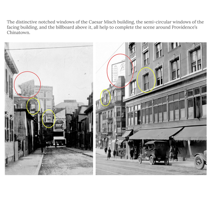
Other photos show adjacent buildings such as the Conrad Building and the Caesar Misch building at 400 Westminster. The car pictured is also a Ford Model A, helping to date the photo.

The distinctive notched windows of the Caesar Misch building, the semi-circular windows of the facing building, and the billboard above it, all help to complete the scene around Providence’s Chinatown.

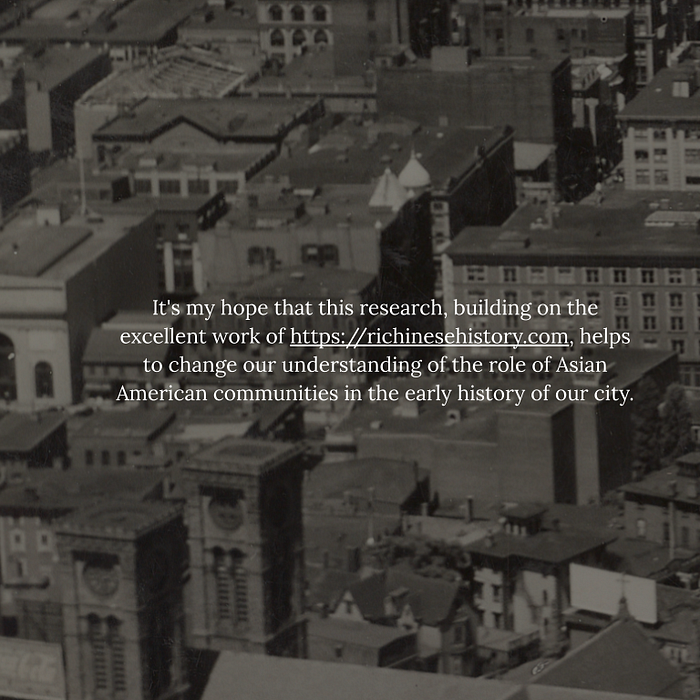
It’s my hope that this research, building on the excellent work of richinesehistory.com, helps to change our understanding of the role of Asian American communities in the early history of our city.

Diving deep into the @provlib archives and piecing this together has been a powerful and moving experience! I’m excited to share more of my research and reconstruction as it evolves.
Many thanks also to @AS220 for their support in this work, as their Empire St location directly faces what was once the heart of Providence Chinatown and is now Empire St. ❤️
Thanks to all those who’ve expressed interest and support! A drawing based on this research is part of the @AS220 Artists Calendar, now available for $30–50 sliding scale:
Update, Jan 26 2022: I’m super excited to share that I was awarded a @rihumanities mini-grant to continue my research into Providence’s erased Chinatown — with support from @as220 & Movement Education Outdoors — many thanks to all of these orgs!
Over the next 3 months I’ll be posting regular updates with glimpses into my research and reconstruction process, part of a developing methodology I’m calling #relationalReconstruction — a reclaiming of the archives and a recentering of human stories, voices…
…and especially a feeling of place and belonging, in contrast to the ways which archives so often tell our stories through exoticizing, trauma, and colonial gaze.
Inspired by the work of Aida Issakhankyzy, Aisha Jandosova, Alicia Renee Ball and others to explore histories as a means of celebrating the past and future of ancestral knowledge — through re-existencia, coined by Adolfo Albán Achinte and celebrated by Madina Tlostanova.
I’ve started by going back through the photos I was able to find of Chinatown and its surrounding streets, between 1900–1930, and placing them on a map of the area. Thanks to @provlib for assistance with the image search!
My goal will be to find or reconstruct facades of every building in Providence’s Chinatown and surrounding streets as well as I can, as a first step towards creating a 3D model. Some will need to be created using photos of buildings from the same time period.
Finally I’ll be mapping these onto a real 3D model and uploading it to Mozilla Hubs. Stay tuned for more as this develops! And follow my work on IG stories for more regular day to day updates!
https://instagram.com/unterbahn/
Aisha Jandosova’s work: https://instagram.com/towardsanidealplace
Aida’s Issakhankyzy work: https://instagram.com/uaqytjaryqkenistik/
Alicia Renee Ball’s work: https://instagram.com/aliciareneeball/
Thanks again to @rihumanities for their support!
